Raja Ampat sits at the northwestern tip of Indonesian New Guinea, in the province of Southwest Papua, scattered across roughly 40,000 square kilometres of ocean just off the Bird's Head Peninsula. If you want the one-sentence answer, that is it. But almost nobody asking where Raja Ampat is actually wants a coordinate. They want to know how far it is from somewhere they recognise, whether it is the same thing as Papua New Guinea, and what its position on the map means for the trip they are trying to plan.
We run boats through these islands most of the year, and the location question comes up in almost every first enquiry, usually phrased as some version of "so where exactly is this place". The honest answer involves a little geography and a lot of practical consequence, because the reason the Raja Ampat islands hold more coral and fish species than anywhere else measured on Earth is inseparable from where they sit. Remote enough to have been spared, positioned exactly where the ocean pushes its richest water through. This guide covers the country, the province, the four islands the name refers to, real distances and flight times from the cities people actually fly from, the time zone, and the honest version of how remote it is once you are there.
The short answer, with the detail that matters
Raja Ampat is in Indonesia. Specifically, it is a regency, an Indonesian administrative district, within the province of Southwest Papua, which was carved out of the older West Papua province in 2022. The provincial capital is the city of Sorong, on the mainland tip of the peninsula, and Sorong is where essentially every visitor arrives because it holds the only airport with useful connections. The regency's own administrative capital is Waisai, a small town on the southern coast of Waigeo island, about two hours away by ferry.
Geographically the islands straddle the equator. Most of the archipelago sits between roughly half a degree north and two degrees south, around 129 to 132 degrees east, which in practical terms means you can cross the line between hemispheres during a single day's diving without noticing. There are somewhere around 1,500 islands, islets, cays and emergent rocks depending on who is counting and what qualifies as an island, spread over an area of sea considerably larger than Switzerland. Land accounts for a small fraction of that total. This is a seascape with islands in it rather than an island group with sea around it, and that distinction shapes everything about how you travel there.
The four kings
The name means "Four Kings" in Indonesian, and it refers to the four largest islands: Waigeo in the north, Batanta just south of it, Salawati closer to the mainland, and Misool away to the south. Local legend has it that a woman found seven eggs, four of which hatched into kings who each took one of the islands. The remaining three became a ghost, a woman, and a stone, which is the sort of detail that makes far more sense after a week of watching these islands emerge out of morning haze than it does written down.
For a diver, the four kings are a useful mental map because the archipelago's diving divides along roughly those lines. Waigeo and Batanta face each other across the Dampier Strait, which is the busy central corridor where most first trips concentrate and where the manta cleaning stations sit. Misool, five or six hours' sailing to the south, is a separate world of soft coral walls and limestone lagoons inside a large no-take conservation area, and we have written about diving Misool in its own right because it genuinely deserves the separation. Salawati sees comparatively few divers. North and west of Waigeo lie Wayag and Kawe, the postcard karst formations that appear on every piece of Raja Ampat marketing including, in fairness, some of ours.
Which country, and the confusions worth clearing up
Three misunderstandings come up often enough that they are worth addressing directly, because they change how people plan.
Raja Ampat is not in Papua New Guinea. The island of New Guinea is divided down the middle: the eastern half is the independent country of Papua New Guinea, the western half is Indonesian. Raja Ampat sits off the far western end, well inside Indonesia, and the border is about 800 kilometres away. This matters practically because it determines your visa, your currency, your carrier options and your entry procedure. You are travelling to Indonesia, full stop.
It is not near Bali, whatever the brochures imply. Bali is roughly 2,000 kilometres to the west. That is comparable to the distance from London to Athens, or from Los Angeles to Kansas City. Plenty of itineraries pair the two because both are in Indonesia, but nobody should book them expecting a short hop.
It is not interchangeable with Komodo. These are the two destinations Indonesian diving is famous for, and they sit about 1,500 kilometres apart in different provinces with opposite peak seasons. Komodo is in the Lesser Sunda islands, a short flight from Bali, and it dives best from roughly April to November. Raja Ampat is far east, harder to reach, and dives best from October to April. Choosing between them is a real decision rather than a matter of taste, and the geography is most of the reason why.
How far is it, really, from where you are
Distances in eastern Indonesia are deceptive because the country is so wide. Indonesia spans about 5,100 kilometres from end to end, comparable to the width of the continental United States, and Raja Ampat sits near the far eastern edge of it. Sorong has no international flights, so every arrival routes through an Indonesian hub, usually Jakarta or Makassar and occasionally Manado.
Here is the honest arithmetic from the cities our guests most often start in. Total journey times assume one overnight or one long layover, which is what almost every routing requires in practice.
| Starting point | Straight-line distance to Sorong | Realistic total travel time | Usual routing |
|---|---|---|---|
| Bali (Denpasar) | ~2,000 km | 7 to 12 hours | Via Makassar, occasionally direct |
| Jakarta | ~2,800 km | 7 to 14 hours | Via Makassar, or overnight direct |
| Singapore | ~3,050 km | 14 to 20 hours | Via Jakarta or Makassar |
| Sydney | ~4,000 km | 20 to 28 hours | Via Denpasar or Jakarta |
| Amsterdam | ~12,500 km | 28 to 34 hours | Via a Gulf or Asian hub, then Jakarta |
| Los Angeles | ~12,700 km | 32 to 40 hours | Via Tokyo, Seoul, Taipei or Singapore, then Jakarta |
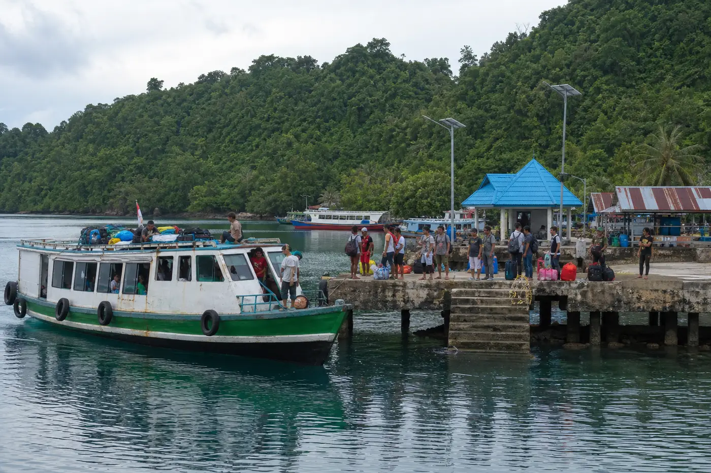
Two things fall out of that table. First, the flight from an Indonesian hub to Sorong is not the hard part; it is a four to five hour domestic leg, less than most people expect. The hard part is that it usually departs at an hour that forces an overnight somewhere. Second, nobody arrives fresh. We build our boarding schedules around that assumption, and if you are coming from North America or Europe we would push you hard toward arriving a day early rather than connecting straight through. We break the routings down properly in our guide to how to get to Raja Ampat, including the specific connections that work and the ones that leave you stranded in Sorong for a night.
The time zone nobody checks until they land
Indonesia has three time zones, and Raja Ampat sits in the easternmost, Waktu Indonesia Timur, usually written WIT and running at UTC+9. That is the same clock as Tokyo and Seoul, and two hours ahead of Jakarta and Bali, which run on UTC+7. A surprising number of people book domestic connections without noticing the shift, and it is the single most common reason a guest miscalculates their arrival buffer. If you are landing in Sorong from Jakarta, you lose two hours on paper that you never spent in the air. Our Indonesia timezone guide covers the whole system if you are moving between regions on one trip.
Sitting on the equator at the eastern edge of a time zone also produces early light. Sunrise lands somewhere around six in the morning year round and darkness comes not long after six in the evening, with very little seasonal variation. There is no long tropical evening. In practice that is why liveaboard days here start early and why the dusk dive is genuinely a dusk dive rather than something you squeeze in at eight.
The underwater map: where the diving actually happens
Knowing where Raja Ampat is on a world map tells you almost nothing about where you will dive, because the archipelago is far too big to cover in one trip. Five zones matter.
The Dampier Strait is the channel between Waigeo and Batanta, and it is the busy heart of the region. Cape Kri, Blue Magic, Sardine Reef, Mioskon and the manta stations at Manta Sandy and Arborek all sit within a couple of hours of each other. Water funnels through the strait on every tide, which is why the fish density is what it is and why the currents demand respect. Most seven-night itineraries are effectively Dampier itineraries with excursions.
Misool occupies the south, and reaching it involves a night crossing. It is the region's conservation showpiece, with soft coral walls, shark nurseries and lagoons that look prehistoric. Boats need ten nights or more to do both Misool and the north properly, which is the single most common length mistake we see in enquiries.
The far north, meaning Wayag, Kawe and the Aljui Bay area, delivers the iconic mushroom-island scenery topside and quieter, more variable diving below. Beautiful, but a trip built only around the north tends to disappoint divers who came for fish density.
The Fam islands and Penemu sit between the strait and the north, and hold Melissa's Garden, which is among the healthiest hard coral gardens anywhere. Kofiau, far west and rarely visited, appears mainly on longer expedition routes. If you are trying to work out which of these your itinerary should include, our breakdown of the best dive sites in Raja Ampat maps the sites onto the zones.
Why this particular position produces the richest reef on Earth
Raja Ampat's location is not incidental to its biodiversity. It sits at the dead centre of the Coral Triangle, the roughly six million square kilometre region spanning Indonesia, Malaysia, the Philippines, Papua New Guinea, Timor-Leste and the Solomon Islands that holds around 76 percent of the world's known coral species. Within that triangle, Raja Ampat is the peak. Surveys have recorded well over 550 species of hard coral here, something close to three quarters of the global total, in an area you could sail across in two days.
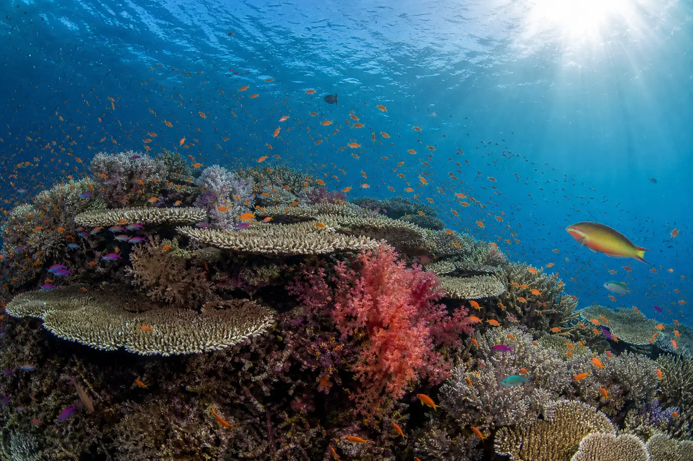
The mechanism is oceanographic. The Indonesian Throughflow, the enormous current system that moves warm water from the Pacific into the Indian Ocean, threads through the Indonesian archipelago, and the Bird's Head region sits right in its path. That flow delivers nutrients continuously, keeps water temperatures stable in the high twenties, and, critically, carries coral and fish larvae between reefs. A reef system positioned in a larval superhighway recovers from damage faster and accumulates species over geological time in a way isolated reefs cannot. Add a maze of 1,500 islands creating thousands of kilometres of sheltered shoreline in every possible orientation to light and current, and you get an absurd number of distinct micro-habitats packed into a small area. We covered the wider picture in our piece on the Indonesia Coral Triangle.
Remoteness did the rest. The reefs that suffered most across Southeast Asia were the accessible ones, close to large populations and industrial fishing fleets. Raja Ampat's distance from everywhere, combined with a genuinely effective network of marine protected areas and no-take zones established from the mid-2000s onward, meant much of it was still intact when the diving world arrived. That protection is funded partly by the entrance permit every visitor buys, which is worth remembering when it appears on your invoice.
How remote is it once you are there
This is the part of the location question that has real consequences, and it deserves a straight answer rather than a marketing one.
Sorong is a working city of a few hundred thousand people with hospitals, hotels, ATMs and a container port. It is not a frontier outpost. But once you leave Sorong harbour you are in a genuinely thin-infrastructure environment. Mobile signal exists patchily around Waisai and the Dampier Strait and disappears entirely across large stretches of the north and around Misool. Many boats, ours included, run satellite internet, but nobody should plan on reliable connectivity. There are no towns of consequence beyond Waisai. Fuel, fresh water and food all come from Sorong, which is why itineraries are shaped the way they are.
Medically, the practical position is that serious problems route back to Sorong first and then onward to Makassar, Jakarta or Singapore. Hyperbaric facilities exist in the region but availability should never be assumed, and evacuation from the far north or Misool is measured in hours rather than minutes. This is exactly why dive insurance covering evacuation is a condition of boarding for most reputable operators, why conservative profiles matter here, and why the nitrox question is worth settling before you travel rather than on the boat. It is also a reason we are firm with guests about the flying after diving interval: your flight out of Sorong is the first leg of a long journey, not the end of one.
One story that captures the geography better than any distance figure. A few seasons ago a guest missed the Jakarta to Sorong connection by twenty minutes after a delay out of Europe. In most destinations that costs you a morning. Here it cost a full day, because the useful flights to Sorong are limited and the next workable one was the following morning, by which point the boat had to sail to keep the itinerary. We rerouted him to join us at Waisai a day later via the ferry, which worked, but the arithmetic was uncomfortably tight. He now arrives two days early on principle, and honestly, so should everyone flying in from long haul.
Where you actually stay, and what location dictates
Because the archipelago is so spread out, where you sleep determines what you can dive, more so than in almost any other destination. A land-based stay puts you within day-boat range of one area, most often the Dampier Strait from a homestay or resort on Kri, Gam or Waisai. That is a perfectly good trip and much the cheaper one, and it suits travellers on flexible dates or with non-diving partners.
Solving that distance problem is the entire point of an Indonesia liveaboard. It moves while you sleep, which is the only practical way to combine the strait with Misool or the far north inside one holiday. The trade-off is that you commit to a route and a schedule. Our own view, formed from running both kinds of guest through these islands, is that seven nights aboard covers the central region well, ten to twelve nights is what Misool and the north actually require, and anything under five nights is better spent in Komodo where the sites sit closer together. If you are weighing timing on top of that, the best time to visit Raja Ampat is a separate and equally consequential decision.
The neighbours: what else sits nearby
Raja Ampat anchors the northwestern corner of a wider region that liveaboards work as a single seasonal circuit, and knowing the neighbours helps explain why certain itineraries exist.
Directly south along the Papuan coast lies Triton Bay, a separate regency roughly 700 kilometres away, with soft coral growth that rivals Misool and resident whale sharks under the fishing platforms. It runs on a similar season and appears on longer expedition routes, and we cover it in our guide to Triton Bay diving. East of that sits Cenderawasih Bay, further still, famous for the same whale sharks in far greater numbers. West and south, across open water, the Banda Sea forms the classic crossing that boats make in the transitional months, which is how a single vessel can dive Raja Ampat from October to April and Komodo through the middle of the year.
That seasonal migration is a direct product of geography. The northwest monsoon that calms Raja Ampat is the same system that roughens Komodo, and the reverse holds six months later. Boats follow the weather across 1,500 kilometres twice a year, which is why the answer to "can I dive Raja Ampat in July" is usually a polite redirection rather than a yes.
Practical consequences of the location, in order of how often they bite
Everything above turns into a short list of planning decisions that people who understand the geography get right and people who do not tend to get wrong.
- Build a buffer day in Sorong or Jakarta. The connection to Sorong is the fragile link in the chain and there is no same-day recovery from a missed one.
- Check your domestic baggage allowance separately. Indonesian domestic carriers on the Sorong legs are considerably less generous than the long-haul flight that got you to Indonesia, and dive gear is heavy.
- Carry cash in rupiah. Sorong has ATMs. Beyond it, card infrastructure is thin to nonexistent, and permits, tips and incidentals are cash matters.
- Set expectations on connectivity with anyone at home or at work who will worry when you go quiet for a week.
- Budget the marine park permit as a separate line item, and treat it as a conservation contribution rather than a tax, because that is functionally what it is.
- Do not plan a tight onward flight after the trip. The no-fly interval after repetitive diving plus a multi-leg journey home needs a full day of slack.
So, where is Raja Ampat
Off the northwestern tip of Indonesian New Guinea, in Southwest Papua province, straddling the equator, about 2,000 kilometres east of Bali and reachable only by connecting through an Indonesian hub to the city of Sorong. Around 1,500 islands spread over an area of sea larger than several European countries, sitting precisely in the path of the current system that made it the most biodiverse marine environment anyone has yet measured.
The location is the whole story. It is far enough from everywhere that it survived the century that damaged most tropical reefs, and positioned exactly where the ocean concentrates its life. Those two facts are why the journey takes as long as it does and why, in our entirely partial opinion, roughly nobody who makes it regrets the trip. If you have worked out the where and want the how, our routing guide to getting to Raja Ampat picks up exactly where this leaves off.